by Matt Gunn | Dec 2, 2021 | News
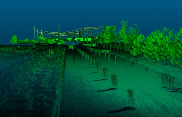
Leveraging your Geo-MMS for Detailed Road Surface & Infrastructure Modeling Following the economic downturn experienced in 2020, it is expected the US will significantly increase investment over the next number of years into the country’s infrastructure (e.g....

by Matt Gunn | Nov 30, 2021 | News
AEVEX Aerospace, a full-spectrum provider of innovative aircraft, remote sensing, and analysis solutions to government and commercial clients, announced today that it has received two awards under the General Services Administration (GSA) 10-year ASTRO contract. This...
by Matt Gunn | Nov 19, 2021 | News
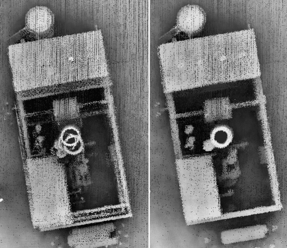
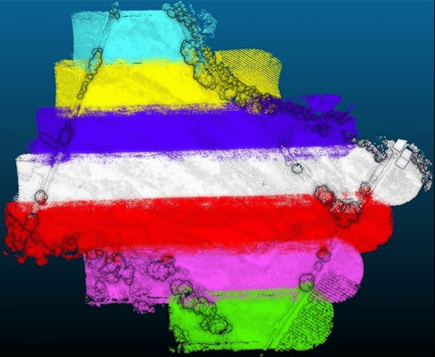
Understanding the Role and Impact of Each on your UAV-LiDAR Missions This blog (second in a two-part series) continues our explanation of the variables which influence boresight calibration and strip alignment when flying drone-based LiDAR missions. If you missed the...
by Matt Gunn | Nov 15, 2021 | News
Understanding Two Critical Principles of LiDAR Data Acquisition If you are familiar with any type of LiDAR data acquisition, you have likely stumbled across terms including ‘boresight calibration’ and ‘strip alignment’ (or strip adjustment). These terms relate to...
by Matt Gunn | Nov 15, 2021 | News
AEVEX Aerospace, a full-spectrum provider of innovative aircraft, remote sensing, and analysis solutions to government and commercial clients, announced today that the company has received a prime contract award on the Navy’s 10-year, $5B SeaPort Next Generation (NxG)...

by Matt Gunn | Nov 2, 2021 | News
NEWS PROVIDED BY Viasat, Inc. Nov 02, 2021, 08:00 ET CARLSBAD and SOLANA BEACH, Calif., Nov. 2, 2021 /PRNewswire/ — Viasat Inc. (NASDAQ: VSAT), a global communications company, and AEVEX Aerospace, an industry leader in aerial intelligence solutions, are working...